


A strong cold front is forecast to Western Australia's southern coastline.
The Bureau of Meteorology issued a severe weather warning on Tuesday afternoon, with concerns of damaging winds, abnormally hide tides and damaging surf to hit the coastline.
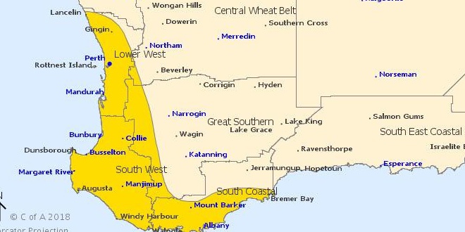
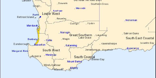
The passage of a strong cold front and deep low will result in the potential for severe weather conditions across southwest WA during Wednesday.
The worst weather is expected to hit from Mandurah to Walpole with winds of up to 100 kilometres per hour forecast to hit around 10am on Wednesday.
Tides between Mandurah and Walpole are likely to rise above the normal high tide mark early Wednesday morning with very rough seas and potential flooding of low-lying coastal areas
Damaging surf conditions have also been included in the severe weather warning, with waters at Mandurah, Perth and Harvey all expected to be affected.
The Bureau said thunderstorms and small hail are also possible with the passage of the cold front.
Residents are being urged to prepare their homes and properties for storms today.
The Department of Fire and Emergency Services said people should unplug electrical appliances, close your curtain and blinds and to stay inside, or if outside take cover away from trees and powerlines.
Beachgoers, boaters and surfers have also been encouraged to leave the water as dangerous swells pick up.
MANDURAH FORECAST
Wednesday July 25 Min 13, Max 18. A few showers. 10 to 20mm
Thursday July 26 Min 11, Max 16. Possible shower. 0 to 0.4mm
Friday July 27 Min 11, Max 18. Shower or two. 0 to 3mm
Saturday July 28 Min 10, Max 18. Shower or two. 0 to 1mm
Sunday July 29 Min 12, Max 18. Shower or two. 0 to 4mm
Monday July 30 Min 12, Max 18. Possible shower. 0 to 1mm
 Perth to Bunbury train service returns
 Missing woman found safe and well
 Community fed up with teenage hoons terrorising Halls Head oval
 Southern suburbs electrician claims $1.8 million Lotto win
 Works continue on Pinjarra's Munday Avenue extension
 Halls Head support worker charged with historic child sex offences
 Severe thunderstorm warning cancelled for Mandurah, Bunbury
 Fortnightly red bin collections to remain in the City of Rockingham after council rejects motion
 Rate rises on the way for Rockingham, Mandurah ratepayers