


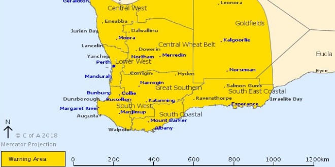
A severe weather warning remains in place with strong winds and a possible storm forecast for Mandurah.
The Bureau of Meteorology's severe weather warning for the lower west remains in place today.
More rain and wind gusts are predicted to sweep across Mandurah this morning, with this kind of weather forecast only seen about five times per year in Western Australia.
There's already been 6.6mm of rain recorded with wind gusts reaching 78km/h just after five o'clock this morning.
The bureau said a strengthening northerly flow ahead of a strong cold front will cause damaging winds and abnormally high tides ahead of a strong cold front that will move through during Tuesday.
The front is expected near the southwest Capes about 8am Tuesday morning and lie near Perth to Albany at around midday.
Wind gusts are expected to reach 100km/h with the threat of damage to homes and property lingering for coastal areas including the Peel region.
Winds will ease over western coastal parts during Tuesday afternoon.
The heaviest rainfall is expected on the coast between Jurien Bay and Walpole.
The Department of Fire and Emergency Services is advising people to find shelter away from trees and power lines if outside today.
People inside should stay away from windows, unplug electrical appliances and tie down loose outdoor items.
Mainroads is also reminding motorists to use caution on the roads.
 Mandurah Crab Fest boasts huge range of free, family friendly entertainment
 Fuel prices surge in Perth, Mandurah
 Teen boys charged over Mandurah burglaries
 Tragic update in search for missing man Robert Snyder
 Premier Roger Cook to leave Kwinana electorate, move to Perth
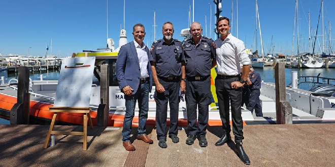 Mandurah Marine Rescue's new vessel named in memory of nun who survived 1959 boating accident
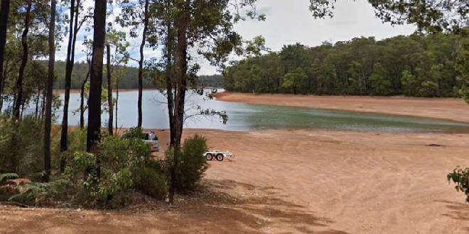 Teen dies in motorbike crash at Waroona Dam
 Shark alert issued after whale carcass reported at Preston Beach
 Kwinana businesses to refuse serving students during school hours